
Neu:
Structural Geological Interpretation of Settlement Patterns of Red Wood Ants (Formica rufa group) in Southwest Germany between the Black Forest and the Swabian Alb
Doi: 10.20944/preprints202312.1696.v1
Website: https://www.preprints.org/manuscript/202312.1696/v1
Hügelbauende Waldameisen der Gattung Formica als Bioindikatoren gaspermeabler Verwerfungszonen
Seit 20 Jahren haben wir von der Universität Duisburg-Essen aus das Phänomen der Standorte von hügelbauenden Waldameisen auf gaspermeablen tektonischen Störungszonen der Erdkruste untersucht. Hieraus entwickelten sich weiterführende Forschungsprojekte, in denen die Eigenschaften der Störungen hinsichtlich der Entstehung des Lebens, energetischen Ressourcen und Erdbeben betrachtet wurden. Die Standorte von Formica Kolonien treten häufig mit ungewöhnlich hohen CO2 Konzentrationen im Umfeld der Nester auf. An einigen Stellen ist Methan das vorherrschende Gas in der Umgebung. Erhöhte Helium Konzentrationen finden sich bei unmittelbarer Lage der Nester über der gaspermeablen Störung. CO2 reiche Sickerwässer und Quellaustritte im Umfeld der Störungen sind durch kolloidale Eisenhydroxidausfällungen und Schwimmeisen gekennzeichnet.
Über die Gründe für die ungewöhnliche Standortwahl entwickelten wir unterschiedlichste Hypothesen. Hierbei wurden höhere Temperaturen im Winter durch die Gase aus der Tiefe, Feuchtigkeit, Biofilme, Infektionsminderung durch CO2 und einige mehr diskutiert. Inzwischen haben sich durch weiterführende Untersuchungen neue Überlegungen ergeben, die in nächster Zeit auf ihre Relevanz überprüft werden sollen.
Die größten existenzbedrohenden Belastungen der Waldameisennester der Gattung Formica sind:
1) Pilze aus dem benachbarten Waldboden, die in kürzester Zeit ohne Gegenmaßnahmen die Nester erobern würden.
2) Virus- und bakterielle Infektionen, die aufgrund der hohen Individuen Dichte auf engstem Raum ohne Gegenmittel schnell zu Epidemien führen könnten.
3) Hohe Temperaturen durch bakterielle Umsetzung feuchten organischen Materials (vergleichbar mit Heu-Selbstentzündung -
https://de.wikipedia.org/wiki/Heuselbstentzündung ).
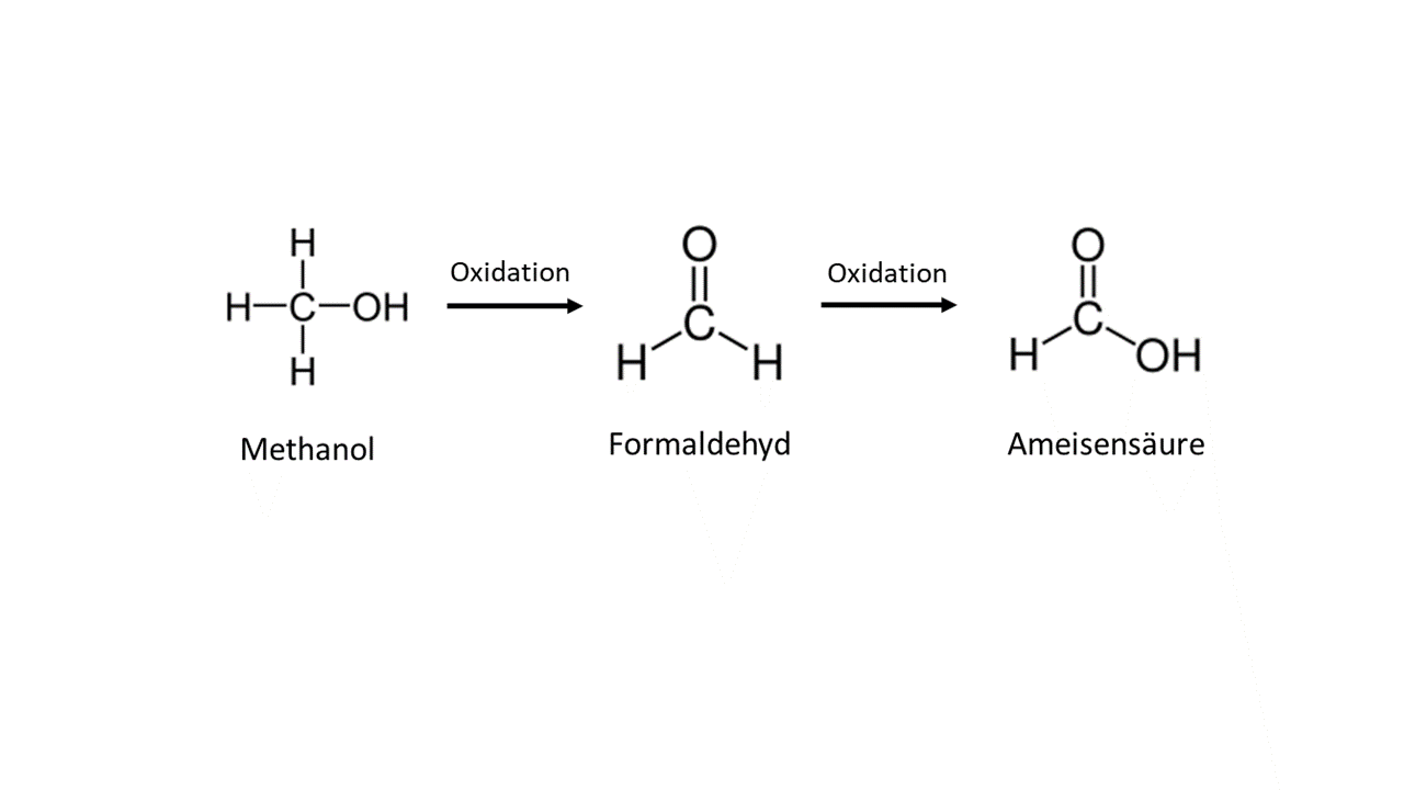
Funde von geringen Konzentrationen Wasserstoff in den gaspermeablen CO2 führenden Störungen deuten darauf hin, dass in der Tiefe bei höheren Drucken und Temperaturen aus CO2 und Wasserstoff Methanol gebildet werden kann. Reaktionsunterstützende Katalysatoren sind in den mineralisierten Spalten in der Tiefe vorhanden (Gangerze).
Das CO2 dient als Trägergas und kann Methanol in höhere Bereiche transportieren, wo es in Kontakt mit Sauerstoff zu Formaldehyd oxidiert wird. Inwieweit Archaeen und Bakterien, die Methanol als Energiequelle nutzen, Formaldehyd bei bestimmten Verhältnissen freisetzen können, ist Teil der geplanten Untersuchungen.
Formaldehyd hat stark antiseptische Eigenschaften. Es inaktiviert die meisten Bakterien, Viren, Pilze sowie ihre Sporen und ist somit ein Desinfektionsmittel und in geeigneten Konzentrationen ein sehr wirksames Fungizid. Durch Oxidation wird aus Formaldehyd Ameisensäure gebildet. Auffällig ist, dass Formica die einzige Gattung ist, die überwiegend Ameisensäure zu Verteidigungszwecken bildet.
Formaldehyd wird in einer Gasmischung mit CO₂ hauptsächlich zur Desinfektion und Sterilisation in geschlossenen Umgebungen verwendet, insbesondere für die Luftdesinfektion und die Sterilisation von Räumen oder Geräten. Die genaue Konzentration von Formaldehyd in einer solchen Gasmischung hängt von verschiedenen Faktoren ab, wie der gewünschten Desinfektionswirkung sowie der Dauer der Exposition und der spezifischen Anwendung.
Das CO2 kann nicht nur als Trägergas auftreten, sondern es kann bei ausreichender Konzentration die Oxidationsprozesse im Nest beeinflussen. Hierdurch können höhere Temperaturen, die durch bakterielle Umsetzungen feuchten organischen Materials entstehen, unterdrückt werden.
Was geschah zu Beginn?
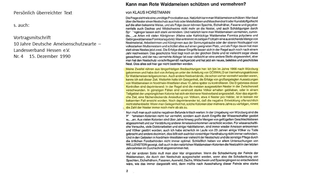
Nach der Entdeckung der ungewöhnlichen Häufung von Formica Nestern auf tektonischen Störungen war zu Beginn die Suche nach den Ursachen der nächste Schritt. Die Häufung der Standorte in Bezug zu Störungen war so deutlich, dass ein Zufall immer unwahrscheinlicher wurde. Bis die Information kam, dass Waldameisen umgesiedelt werden können, um sie zu retten oder andere Waldbereiche damit zu beleben. Das war eigentlich ein k.o. Kriterium für unsere Überlegungen. Wenn sie einfach woanders angesiedelt werden konnten, brauchte es anscheinend nicht eine Standortbedingung, die etwas mit gaspermeablen Störungen zu tun hatte. Nach einigen Recherchen und Kontakten zu Ameisenforschern erhielt ich folgenden Text von K. Horstmann, den er im Rahmen eines Vortrages zusammengestellt hatte:

Am 14. April 2023 verstarb unser lieber Kollege Prof. Dr. Dietrich Klimetzek vom Institut für Forstwissenschaften, Biometrie und Umweltsystemanalyse der Universität Freiburg im Alter von 79 Jahren. Sein plötzlicher Tod hinterlässt eine große Lücke in unserer Forschung über die Standortbedingungen hügelbauender Waldameisen auf gaspermeablen tektonischen Störungszonen. Er war einer von den Ameisenforschern, die neugierig genug waren, um weit über den Tellerrand zu schauen und weit ausgetretene Pfade zu verlassen. Erst im hohen Alter lernte er die von geologischer Seite gemachte Beobachtung kennen, die einen deutlichen Zusammenhang zwischen Bruchzonen in der Erdkruste mit austretendem CO2 und der Standortwahl von Formica belegen. Er musste immer wieder gegen seine Überzeugung eingestehen, dass es diesen Zusammenhang gibt, die Belege im Gelände mit treffsicherer Vorhersage waren einfach zu deutlich. Allerdings diskutierten wir bis zuletzt die Ursachen, bei denen er sich nicht sicher war. Leider schaffte er es nicht mehr, wichtige Daten für eine gemeinsame Veröffentlichung aufzubereiten. Trotzdem ist viel von seinem Wissen in unsere Arbeit der letzten Jahre östlich des Schwarzwaldes eingeflossen (Maresch & Schreiber, 2023). Dietrich Klimetzek war ein Entomologe mit einem ausgeprägten Forscherdrang und einem „Spezies“-eigenen Humor. Wir werden ihn vermissen.
Structural geological interpretation of settlement patterns of red wood ants (Formica rufa group) in Southwest Germany between the Black Forest and the Swabian Alb
Maresch, L., Schreiber, U.
Abstract
Based on the theory that certain geological fault zones surpass the influence of other abiotic and biotic site factors for mound-building red wood ants (Formica rufa group), an area northwest of Tuttlingen with extremely high ant density was systematically surveyed, taking into account official geological maps. Indicators of active fault zones were recorded. These were additionally examined in a model area using a high-resolution digital terrain model (DTM 1-meter). The study area is located in the Swabian Jura at the western edge of the Albstadt shear zone, where recent seismic activity is documented by frequent earthquakes. The earthquakes are considered to be the cause of gas permeability in the strike-slip faults, around which the clustered nesting sites were mapped. More than 2900 nests of the Formica rufa group were mapped and their site conditions analysed in different geomorphological positions. In addition to recording forestry site conditions, a geological classification was carried out, as well as an analysis of soil gases/mofettes in areas with the highest nest densities. The correlation between forestry data and nest sites did not reveal a consistent pattern. In contrast, the relationships with gas-permeable strike-slip faults, though predominantly covered with Quaternary sediments, could be identified through CO2- and CH4-rich gas emissions, mofettes, and doline features. The interpretations were complicated due to different mapping ages and signatures of the geological maps. Fortunately, this issue could be analysed and evaluated in a sub-area with mappings from 1936/71 and 1995 regarding presumed or confirmed fault trajectories. New insights were gained regarding the relationships between Formica nest sites, gas-permeable faults, and groundwater levels on narrow mountain ridges with steep relief. Here, the lateral emission of CO2 depends on the groundwater level and does not occur vertically directly above the fault. C- and H-isotope data of CO2 and CH4 do not show a consistent source. While methane is mainly derived from biological production by Archaea in the upper crust and in swamp areas, CO2 mostly originates from the mantle. The results of the investigations revealed that a multitude of geological and ecological factors must be considered for the interpretation of the occurrences of Formica sites northwest of Tuttlingen. These factors confer a distinct originality to this region, contributing not only to an enhanced understanding of site conditions but also furnishing information regarding environmentally relevant gas emissions.
Beispiel aus der Veröffentlichung:

Fig. 11a, b: Section CE2 (Fig. 1, 3) from the map sheet GK 7918 Spaichingen (State Geological Survey, Mineral Resources, and Mining Baden-Württemberg) southeast of Dürbheim, showing different observations of mapped faults (black, partially dashed lines) from a) 1936/1971 (GM 7918 Spaichingen, 1971) and b) 1995 (GM 7918 Spaichingen, 1995), along with the locations of RWA nests in 2022 (red squares) in the immediate vicinity of the faults (dashed fault lines: inferred). Smaller parallel displacements, cross faults, and Riedel shears, which always occur in association with strike-slip faults (here overprinted by normal faults), are not captured in the available resolution.
